Journey to the centre of New Zealand
New Zealand has a new geographic centre, and it’s not far from Greytown. David Hancock pulls on his hiking boots and takes us on a guided walk there.
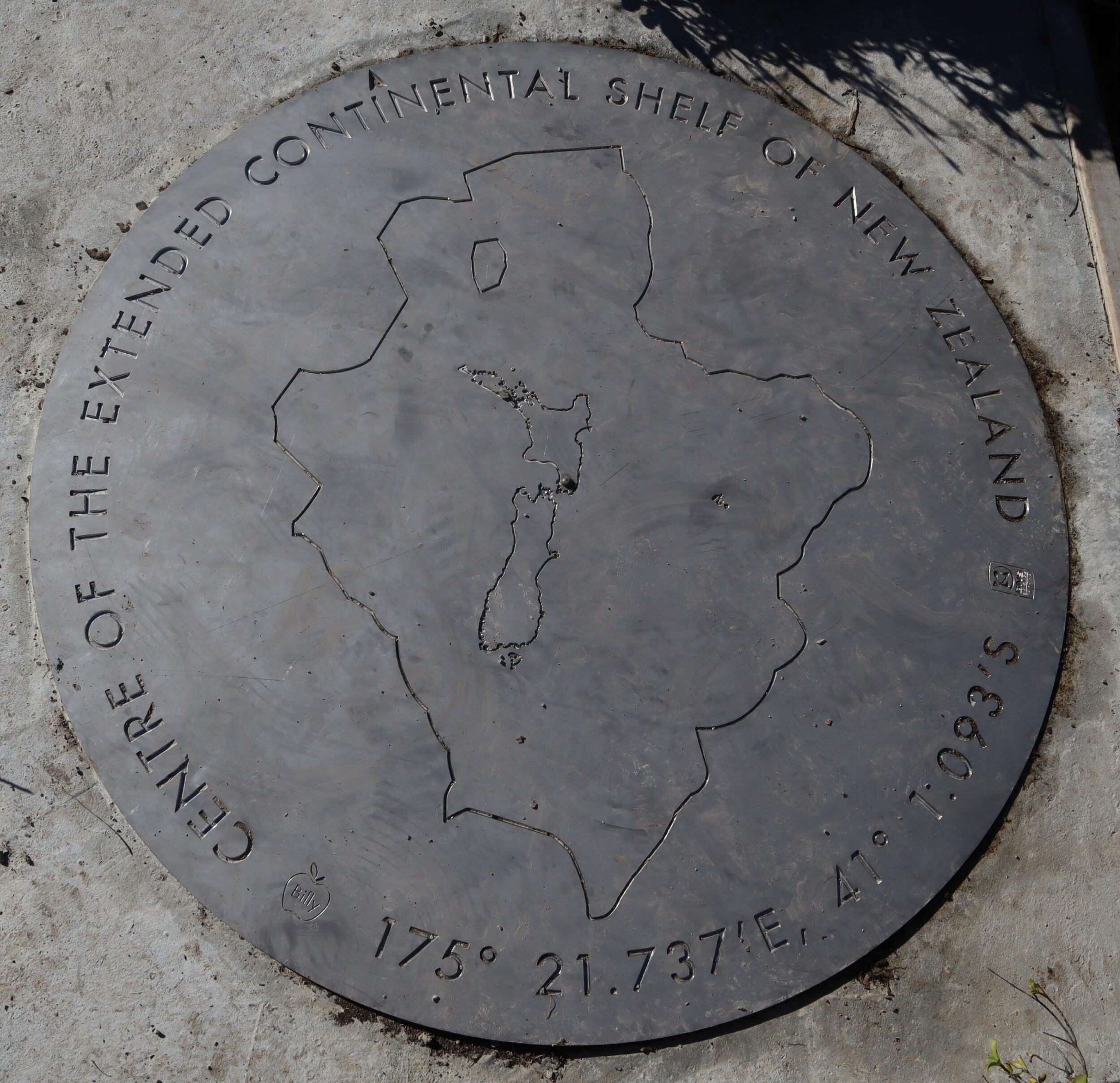
Be it a little-known fact, 95% of New Zealand is sea floor, as recognised by the United Nations. With this mind, GNS Science have recalculated the country’s geographic focus pinpointing the centre of New Zealand a short distance from Greytown, 160km north of where it previously was. A kick in the guts for the city of Nelson perhaps, but a result for Wairarapa.
A plaque marking the bullseye in the Tararua Range on the Mt Reeves track features a one-metre diameter stainless steel artwork. You wouldn’t choose this as a first walk into the Tararuas as there are some steep sections at the beginning and it takes 5-7 hours return.
Mt Reeves Track starts in the Waiohine Gorge, on the Waiohine ‘Valley’ Road. Not to be confused with the ‘Gorge’ road on the other side of the river. In Greytown, turn onto Woodside Road at the service station and head towards the mountains. Cross the railway line, and continue on a dirt road. At the T junction turn right and follow this until you come to a Department of Conservation sign.
The first part of the walk is along farm roads and makes for a nice, easy warm up. You’ll want to be warmed up, because in a few hundred metres you’ll see a big orange triangle blaze, pointing to the left and straight up a hill. There’s also a small wooden arrow saying Reeves Track. Look straight up and you’ll see another similar orange triangle, and there’s a steep hill between you and it.

ADVERTISEMENT
There’s a wire farm fence to climb under and you should assume that this fence is alive with electricity. I politely lifted the wire for my tramping mate and felt the brief pain of my mistake.
At the top of the hill you enter a forestry block which continues straight uphill for about another 50m. From here the track mercifully turns left on a gentler contour which you follow until you leave the pine forest and enter the forest park. From here the walk rolls up and down over mounds following a well blazed trail.
Mt Reeves Track is an old route – you’ll see modern orange blazes, tin can lids from the era before, and hatchet notches in trees which preceded them as the original route over the Tararua Ranges, first pioneered in the 1930s.
The track opens up with views over Wairarapa towns, farmland, Lake Wairarapa and Aorangi Range as you gain altitude. The plaque is at about 750m so there’s a fair amount of climbing.
Rocky knob is a key view point and good guide to how you’re going. The centre of New Zealand is roughly another 2.3km from here. (Don’t confuse this knob with the next one which is also rocky.)
On reaching the plaque you might want to consider going on for another half hour to the summit of Mt Reeves (899m. Either way the plaque or summit are both great photo and lunch stops.
Topographical maps and Department of Conservation hut passes can be purchased at the Masterton i-SITE Visitor Centre. Check the Tararua Range mountain forecast before setting out.